
 Mikhaylovka
Dyrestuy
Mikhaylovka
Mayskiy
Novobessergenevka
Tersky District
Lesnoy
Tertezh
Kuz'minskiye Otverzhki
Mikhaylovka
Dyrestuy
Mikhaylovka
Mayskiy
Novobessergenevka
Tersky District
Lesnoy
Tertezh
Kuz'minskiye Otverzhki
City Park on the map, Ostrogozhsk, Russian Federation
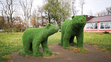
Photo
Where is located City Park
City Park — local attraction, which is located at Ulitsa Kramskogo, 26, Ostrogozhsk, Voronezh Oblast, 397855 and belongs to the category — park. Average visitor rating for this place — 4.4 (according to 569 ratings, information from open sources and relevant for 2022).
Exact location — City Park, marked on the map with a red marker.
You can get directions to City Park on the map from your location.
What else is interesting in Ostrogozhsk? You can see all the sights if you go to the city page.
Coordinates
City Park, Russian Federation coordinates in decimal format: latitude — 50.86347672093032, longitude — 39.07801989811285. When converted to degrees, minutes, seconds City Park has the following coordinates: 50°51′48.52 north latitude and 39°4′40.87 east longitude.
Nearby cities
The largest cities that are located nearby:
- Voronezh — 91 km
- Belgorod — 175 km
- Lipetsk — 198 km
- Yelets — 198 km
- Kursk — 220 km
- Luhansk
 — 253 km
 - Tambov — 260 km
- Alchevs'k — 264 km
- Horlivka — 292 km
- Sumy
 (Ukraine) — 297 km
 - Donetsk — 327 km
- Pavlohrad (Ukraine) — 349 km
- Poltava (Ukraine) — 352 km
- Novomoskovsk — 352 km
- Shakhty — 359 km
- Tula — 382 km
- Novocherkassk — 388 km
- Taganrog — 402 km
- Bryansk — 407 km
Distance to the capital
Distance to the capital (Moscow) is about — 553 km.