
 Mikhaylovka
Dyrestuy
Mikhaylovka
Mayskiy
Novobessergenevka
Tersky District
Lesnoy
Tertezh
Kuz'minskiye Otverzhki
Mikhaylovka
Dyrestuy
Mikhaylovka
Mayskiy
Novobessergenevka
Tersky District
Lesnoy
Tertezh
Kuz'minskiye Otverzhki
Zadonskiy Svyato-Tikhonovskiy Preobrazhenskiy Zhenskiy Monastyr' on the map, Zadonsk, Russian Federation
Photo
Where is located Zadonskiy Svyato-Tikhonovskiy Preobrazhenskiy Zhenskiy Monastyr'
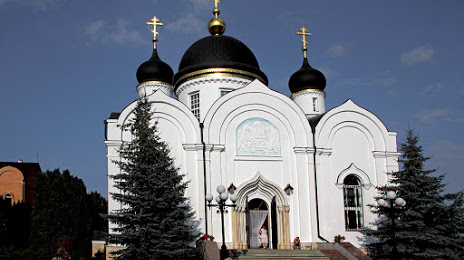
Zadonskiy Svyato-Tikhonovskiy Preobrazhenskiy Zhenskiy Monastyr' — local attraction, which is located at с. Кашары, ул. Монастырская, 2, Zadonsk, Lipetsk Oblast, 399201 and belongs to the category — convent. Average visitor rating for this place — 4.9 (according to 516 ratings, information from open sources and relevant for 2022).
Exact location — Zadonskiy Svyato-Tikhonovskiy Preobrazhenskiy Zhenskiy Monastyr', marked on the map with a red marker.
You can get directions to Zadonskiy Svyato-Tikhonovskiy Preobrazhenskiy Zhenskiy Monastyr' on the map from your location.
What else is interesting in Zadonsk? You can see all the sights if you go to the city page.
Coordinates
Zadonskiy Svyato-Tikhonovskiy Preobrazhenskiy Zhenskiy Monastyr', Russian Federation coordinates in decimal format: latitude — 52.44016387887621, longitude — 38.96270109817103. When converted to degrees, minutes, seconds Zadonskiy Svyato-Tikhonovskiy Preobrazhenskiy Zhenskiy Monastyr' has the following coordinates: 52°26′24.59 north latitude and 38°57′45.72 east longitude.
Nearby cities
The largest cities that are located nearby:
- Yelets — 38 km
- Lipetsk — 51 km
- Voronezh — 81 km
- Tambov — 171 km
- Novomoskovsk — 184 km
- Kursk — 205 km
- Tula — 218 km
- Ryazan — 250 km
- Belgorod — 257 km
- Kaluga — 293 km
- Serpukhov — 295 km
- Kolomna — 299 km
- Bryansk — 314 km
- Sumy
 (Ukraine) — 332 km
 - Obninsk — 336 km
- Podolsk — 347 km
- Izmaylovo — 360 km
- Lyubertsy — 370 km
- Elektrostal — 376 km
Distance to the capital
Distance to the capital (Moscow) is about — 379 km.